

Cart
You have no items in your shopping cart
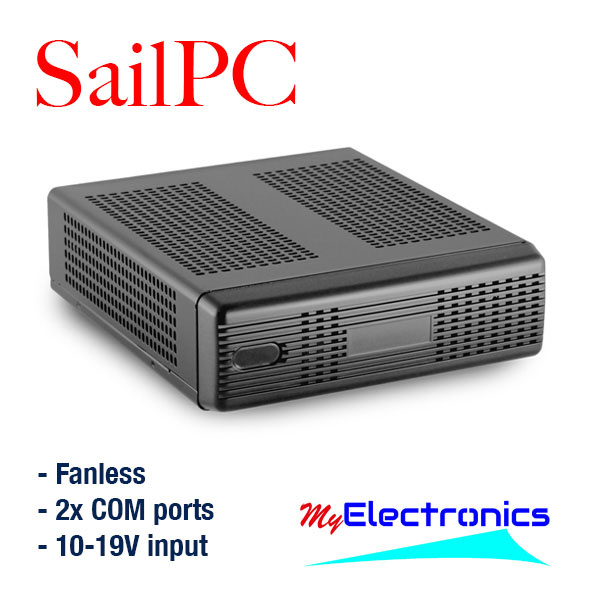
Selecting the right SailPC to combine 3 different NMEA based systems into one Navigation system. Then test with commonly used software such as OpenCPN and PC-Navigo
Uitzoeken van de juiste SailPC om 3 verschillende NMEA systemen te combineren tot één Navigatie systeem. Vervolgens testen met veelgebruikte software zoals OpenCPN en PC-Navigo.
Do you recognize the situation? After years of continuous effort, you finally have everything working with your various systems onboard. A nicely integrated PC, laptop or tablet and the software of your choice, all working to your satisfaction. And then you can't resist going for another ship...
Me too. In this case from a sailboat with mainly Raymarine MFD, radar and fishfinder (Seatalk and Seatalk ng mixed) to a motorboat where (at least) three different brands and generations (VDO, Lowrance and Raymarine) are used interchangeably.
After having worked for 12 years at Imtech Marine and Radio Holland and with a nice experience with sailing on inland water (Dutch lakes) and across the Ocean (Med, Africa, Caribbean), it can not be difficult to set up a full system with the existing equipment, right? But actually I already knew, this will be a hobby-project again, love it! (mostly)
First I discovered that there were no recent maps with the Lowrance HDS-10. Feel free to say even old maps, I believe the Afsluitdijk from 1936 wasn't even on it. That didn't help me much. And then I discovered that new Navionics maps are not only quite expensive but also that A) navigating with the plotter is not nice if you are used to a PC / tablet, and B) that navigating, setting out routes, waypoints and such for inland waterways do not offer the options I need.
Example? "Well boy, do a route from Roermond to Amsterdam" .... and there the Navionics (on the iPad) started calculating. But after about 150 waypoints, he gave up. At that point it wasn't even finished on the first part of the river. Let alone taking bridges and locks into account.
Clearly: We set entirely different requirements for navigational means for inland navigation than for open water. And yet I want to be able to navigate on rivers / set out routes as well as on open water such as the outside of the Wadden Islands and to the Baltic Sea. So it's time for a refocus and a broad perspective.
Navigating with the Lowrance plotter is bound to the maps that are available for this plotter. The wish is to work with a system/software that is suitable for navigating both at sea and on rivers and canals. After an investigation, I opted for the combination of PC-Navigo for inland waterways and OpenCPN for at sea.
This blog is not about what the best software package is or which brand can deliver the best plotter. This is an existing situation on board, to which we want to add and integrate a SailPC with universal software (each of you makes your own choice). We are also curious about the speed of the whole system when everything is tied together and the practical applicability.
Will you be sailing along with me in the coming weeks?
edit: Not enough comments to continue the blog, but the experiences with all software/systems are there! Feel free to send an email if you want to know more :)
Herken je de situatie? Had je (na jaren) eindelijk alles op orde met je verschillende systemen aan boord en heb je lekker je PC, laptop of tablet geïntegreerd met de software van je keuze, moet je zonodig weer van schip veranderen.
Ik dus ook. In dit geval van een zeilboot met voornamelijk Raymarine MFD, radar en fishfinder (Seatalk en Seatalk ng door elkaar) naar een motorboot waar (minstens) drie verschillende merken en generaties (VDO, Lowrance en Raymarine) door elkaar heen gebruikt worden.
Na 12 jaar bij Imtech Marine en Radio Holland gewerkt te hebben en met een aardige ervaring met zeilen op binnenwater IJsselmeer/Waddeneilanden) en over de Oceaan (Med, Afrika, Caribisch gebied) kan het niet moeilijk zijn om dit allegaartje weer naar mijn hand te zetten, toch? Maar eigenlijk wist ik het al, dit wordt weer hobbyen, heerlijk! (meestal)
Als eerste kwam ik erachter dat er bij de Lowrance HDS-10 geen recente kaarten zaten. Zeg maar gerust oude kaarten, ik geloof dat de afsluitdijk er nog niet eens op stond. Daar had ik niks aan. En daarna kwam ik er achter dat nieuwe Navionics kaarten niet alleen vrij kostbaar zijn, maar vooral ook dat A) navigeren met de plotter niet fijn is als je een PC/tablet gewend bent en B) dat navigeren, routes uitzetten, waypoints en dergelijke voor rivieren en kanalen niet de mogelijkheden bieden die ik nodig heb.
Voorbeeldje? "Nou jongen, doe maar eens een route van Roermond naar Amsterdam".... en daar ging de Navionics (op de iPad) aan het rekenen. Maar na een waypointje of 150 gaf ie het op. En toen was ie de Maas nog niet eens af. Heb ik het nog niet over bruggen en sluizen.
Duidelijk: We stellen voor binnenvaart hele andere eisen aan navigatie middelen dan bij groot water. En toch wil ik zowel op rivieren kunnen navigeren/routes uitzetten, als op groot water zoals buitenom naar de Waddeneilanden en naar de Baltische Zee. Tijd dus voor een heroriëntatie en een ruime blik.
Daar gaan we...
Het navigeren met de Lowrance plotter is gebonden aan de kaarten die voor deze plotter beschikbaar zijn. De wens is om met een systeem/software te werken dat geschikt is voor zowel op zee als op rivieren en kanalen te navigeren. Na een onderzoekje heb ik gekozen voor een SailPC met de combinatie PC-Navigo voor het binnenwater en OpenCPN voor op zee.
Deze blog gaat niet over wat het beste software pakket is of welk merk de beste plotter kan leveren. Het gaat hier om een bestaande situatie aan boord, waar we een SailPC met universele software (ieder zijn eigen keus) aan toe willen voegen en integreren. We zijn ook benieuwd naar de snelheid van het geheel als alles aan elkaar geknoopt is en de praktische toepasbaarheid.
Navigeren jullie mee de komende weken?
edit: Te weinig reacties om de blog voort te zetten, maar de ervaringen bij ons zijn er wel! Stuur gerust een email als je meer wilt weten :)
Comments
Be the first to comment...